
Google Maps now allows you to Measure a shortest distance between two or more places
Google maps has been and still is a handy toll for a lot of us. You just input the location and the starting point of your travels and you get route by route instructions as you drive or travel on whatever your mode of transport and not only this you also get alternate routes if certain roads seem to have traffic or some construction work going on on them. Besides this you get the fastest route to your destination. You just can’t go wrong with Google maps.
Now, Google maps has got a lot more interesting, to use. You can now calculate the shortest point between two or more locations on a map. This distance does not factor in roads, trails or any other obstruction, you just get the shortest and I mean the bare minimum between two or more points. This could be useful when it comes to traveling on your own two legs and don’t necessarily need to drive around to that location you have to visit.
More about Google Map new Feature:
This feature is available on both desktop as well as mobile devices.
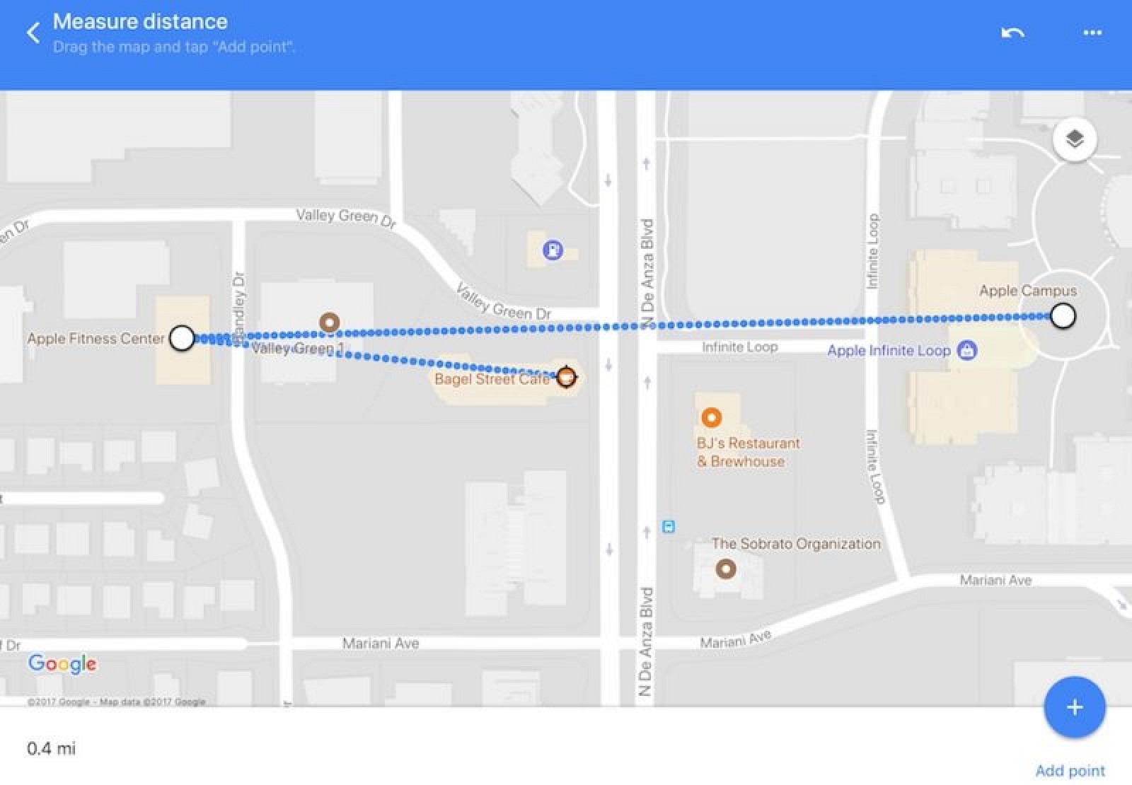
In a desktop situation all you have to do to use the Google maps feature, is right click on the destination you’d like to visit or starting point and then choose “measure distance” from the options given.
Next choose the destination on the map and you’ll get the shortest distance between the two points in kilometers or miles according to your choice.
You can even click elsewhere on the map to add more places to your growing travels or even remove an added place on the map. The places you choose will be highlighted with a black circle.
Once you’re done, all you have to do is click the x at the bottom of the screen to close the page.
Google maps feature on mobile phones:
This feature is also present on both android and iOS devices. In a mobile device all you have to do is long press on the starting point or place you’d like to visit and then when the name of the place is shown below you click on it to choose the “shortest distance” option.
You then slide your fingers to your destination to get the shortest distance between the two points. To add more places to the list just press the add button and use your fingers to select the next location on the map. Again the distance in kilometers or miles is shown at the bottom of the screen.
To remove an added location just click on the undo button and presto you’re done! You can even view the total distance between all the points in Google maps.
You can even get creative with it and draw shapes on the maps just like Google had done to demonstrate the new feature on Google maps.
Google maps rolled out this feature on Tuesday.


