
In earlier days, people used paper roadmaps to find directions for long trips. But Google Earth has changed the way of searching for any direction after its release in the year 2001. Now, we can see the location of the places before we started traveling. It helps us from getting misguided by the wrong directions. It was known as Earth Viewer 3D. A CIA-funded company named Keyhole, Inc innovated it. Google acquired it in 2004. In this article, we will discuss the topic of Google Earth vs Google Maps.
However, these two web applications are completely different. But the main purpose of these apps is to explore the world. In the year 2005, Where two technologies turned the desktop-based map of google into a web application.
What is Google Maps?
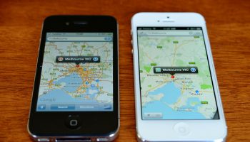
If you want to see your destination whenever you want, then Google maps can help you in this case. According to Wikipedia, this digital map service is a web mapping service. It enables users to get images of satellites, road maps, aerial photography, etc. Moreover, this app lets you know about the traffic conditions each time.
Using this app, you can learn about route planning, such as by which transport you will be able to reach the place by car, foot, bicycle, or public transportation, where 2 Technologies used this web app as a C++ desktop program earlier. Later they convert it into a web application. This app was launched in February 2005.
According to the Daily Express, it is a fundamental navigational app that lets you know about the easiest and fastest route to go from one place to another. If you want to find any place where it is, this web app is a perfect choice.
Each detail you can get from this app is up-to-date. Google Maps’ GPS is beneficial in this case, as it guides you properly by giving the right directions. That’s why if you want to make a trip to Paris or any other place, then it is a good option.
Advantages:
- It helps the users by giving images street by street.
Disadvantages:
- The graphics of this app are not so detailed.
What is Google Earth?
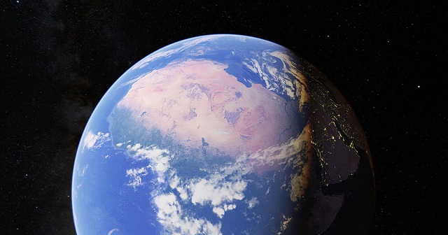
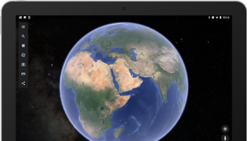
Google Earth that was released in 2001 is a 3D representative of Earth. It shows the directions with satellite images’ help, aerial photography to give the proper direction of any place. Besides, this program can allow you to watch different locations from different angles. Even, you can explore the world only by putting addresses in the app. Users can download this app on their smartphone or tablet.
According to the Daily Express, this app is made especially for explorers. If you want to know about the place before traveling, it is a nice one to select. This app is not designed in a way so that you can navigate anywhere. But, it assists you to search for local landmarks before your arrival. It is an ideal web app to get an excellent view of the entire world.
Advantages:
- You can get high-resolution images, detailed maps of any street, any business address, etc.
- As well as this app offers the users to get Geospatial data, 3D cityscapes, panoramic pictures at street level, historical Imageries.
- It also allows you to know about the weather details.
Disadvantages:
- You are unable to use this app without accessing the network. Moreover, it needs a fast connection.
Google Earth vs Google Maps- What are the differences
Let’s have a look at the comparison of these two web apps.
1. Google Maps assists in finding out the local landmarks and share your location.
This web app is popular due to its incredible turn-by-turn navigation feature. This app lets you know about the real-time traffic details. You can learn about the location, nearby petrol stations, restaurants by using it. This app also helps to share your location. As a result, your friends can track your location by using the Google Maps application.
2. Google Maps can track the history of the location
Google tracks the entire location history of the users. You can see your daily activities and visited places using this app like driving, walking, visiting a market, etc. Besides, it also enables you to explore different bodies in the solar system. Recently, the app also allows viewing the images of the Moon and Mars.
3. Google Earth assists in exploring
This apps allows the users to get a satellite view. But if you are willing to get the details of the things, you should use Google Earth. These satellite images of the Earth app have high resolution compared to the other one. You can explore the topography of any area and size of any building by using satellite data. It can guide you with fly-by tours of specific buildings and full cities. Besides, you can get details here more than the Wikipedia information. However, it doesn’t offer you the detailed data experience that you can get from Google maps.
This app also offers images of Street View. You can assume this app as a part of Google maps. Recently, Google released the Earth’s v9. since the last two years, developers have been working on it. Now, this app comes with a new feature called Knowledge Cards. When you tap on a card, you can see a page describing more details about the place.
However, for the zooming purpose of any location, you should not use the Earth app. This app comes with a new feature that we know as Voyager. With this new feature’s help, the app can allow the users to take virtual tours by including hand-picked places in the map-based stories formation. You can get high-quality landscape pictures of any area with the help of this new feature.
4. Google Earth contains the “I’m Feeling Lucky” button
In the latest version of this Google app, you can see the “I’m Feeling Lucky” button. It is available on Google Search. When you tap on the button, it takes you to any place in the world. It can track the user location with the help of a GPS chip and IP address. But the disadvantage is that it cannot save the record of those places that you visit. And it can’t give high-resolution images. Google Maps can provide about 95 % of that information that most users want to get in any mapping app. However, you can get the most details by using Google Earth.
Which is Best?
We know that Google Earth is mainly for the explorers, whereas Google map is for those who want to use it daily. Google Earth can enable you to travel to various locations, virtually in 3D.
Google Maps are helpful for daily users. As per the the online sources, most people prefer to choose the Google Map app to find out the right direction of any place. They also said that it is an app that can give you up-to-date information. From walking, biking to driving, Google Maps cover all updated details for turn-by-turn navigation.
Conclusion:
We hope, after checking this article based on Google Earth vs Google maps, you can understand the major difference between these two apps.
