
When it comes to making roads safer for everybody, the speed limit is very important. But it may be difficult for drivers to know what the speed limit is. For instance, you are driving in low-visibility conditions, such as on a foggy day, in places with unfamiliar traffic laws, or you don’t know what the speed limit is at a specific moment.How AI and Imagery Keep Speed Limits on Google Maps?
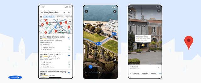
Speed limit information is shown in Google Maps for streets nearby and around the world in order to help drivers navigate. While the information helps drivers to stay safe, it is also useful for automakers. The reason is that they work to increase the assisted driving capabilities in cars.
Let’s have a look at this article to learn how AI and Imagery keep speed limits on Google Maps updated.
How Does AI Help To Identify Speed Limits Around The World?
In order to map the world, people usually rely on data from various sources. The same thing happens when you want to understand the speed limits. Authoritative data from local governments is a vital source that lets people know about the default speed limits for different road types when no signage is there. For instance, the default speed limit in California is 25 miles per hour.
However, several roads are still there that have different speed limits during various weather conditions. You should use AI & imagery to capture all nuances within Google Maps.
The sophisticated AI models come with such designs that let you detect the speed limit information from Street View imagery & 3rd-party imagery sources. AI models are trained on multiple different signs from all different areas of the world. Therefore, no matter — how different a sign is looking, the AI model is able to detect the speed limit.
For instance, signs in the United States could have “speed limit” written on them. Whereas, the sign in Germany shows the number only. As soon as the AI model detects a sign, you can use GPS information from the image to match this to its geographic location. You will get to know when you should change the speed limit shown to you on Google Maps depending on where you are on the route.
How AI And Imagery Keep Speed Limits On Google Maps Updated?
Imagery and data can offer a strong foundation for the model of real-world speed limits. But the speed limit can change constantly, because of which they become hard to update. A few things like construction, community input & long-term traffic conditions can change the speed limit permanently or temporarily.
Google Maps analyzes traffic trends in order to deal with the issue and to understand whether a speed limit change would be there or not. For instance, you can see trends showing that cars are traveling consistently below the speed limit. If it happens, then make sure that the speed limit has been reduced. It may happen when a new school is made. Besides, it can happen when a local government determines that a road is at high risk for accidents.
Once the speed limit in an area is suspected as updated, it is necessary to cross-reference the change with many sources to confirm the change or deny it. These sources can be official data from local governments along with the refreshed Street View imagery.
To improve road safety, pictures of the particular stretch from 3rd party partners that are capable of gathering road information are requested in such areas where recent Street View imagery is not available. A combination of artificial intelligence is used to help the operations team to detect the sign in the images, extract the new speed limit information & update Google Maps, whether the partner has images available.
How Speed Limit Data Is Powering Future Driving Technologies:
For automakers who build cars with assisted or fully automated driving features, the information is useful. When you want a lot of these features to work, cars should know the speed limit as a human would. Being able to do it accurately has become an ever-pressing trouble for automakers, because more policies can regulate the assisted-driving features.
For instance, GSR or General Safety Regulations of the EU need new vehicles that will be registered after July 2024 and come with an ISA or intelligent speed assistance feature that is capable of showcasing the legal speed limit to warn drivers if they go over this. In order to meet the needs, vehicles should offer the accurate speed limits of at least 90% of drive.
Cars have default sensors and cameras that help car manufacturers capture a few essential speed limits. However, due to similar changes, detecting speed limit signs has become very hard, such as inclement weather, physical barriers & poor sign placement. You should know that vehicle sensors are a vital component.
It can assist in keeping Google Maps updated for all. The data is very important when it comes to completing the picture for automakers. With the help of speed limit data, the ISA feature in Volvo’s EX30 passed the EU’s GSR certification. It indicates that EX30 can showcase the legal speed limit even while no clear signs are on the road.
The Bottom Line:
Speed limits are crucial to keep roads safe for cyclists, drivers, and pedestrians. In addition, technology should be enhanced to let automakers build highly accurate assisted driving features. As a result, drivers will always feel confident on roads anywhere in the world.
Frequently Asked Questions:
How is AI used in Google Maps?
It helps to improve the map’s accuracy itself. In order to make detailed maps of buildings, roads, etc, Google includes a combination of user data, Street View imagery, & satellite imagery.
How does Google Maps keep updated?
Google Maps has more than 7000 employees at present, and they work full-time for keeping Google Maps updated. They get information from satellites, cameras, field researchers, & the public.
What type of AI is used in Google Maps?
According to Google, it uses NeRF or neural radiance fields, which is an advanced artificial intelligence technique used to generate these true-to-life scenes. These can turn normal images into 3D representations.


